Wednesday, April 17, 2013

"A Nap. . . That's What I Need!"

I mentioned a couple of days ago that I left Austin on this drive ahead of schedule because I hadn't slept well the night before. I figured there was an even chance I'd run out of steam before I got back home and, sure enough, that's what happened. By the time I got to Vanderpool I'd decided to modify my plans a bit. I skipped the short excursion to Lost Maples State Park, a few miles north, and headed east again, through Medina and Bandera. In Boerne I made a pit stop at the DQ and got a Blizzard to scarf down enroute. I made a mental note to return to Boerne - nice town, in spite of the Saturday afternoon traffic - and made a beeline for Guadalupe River State Park. I really, really needed a nap.

The first time I was here was in late December 2005. Gillian and I were on our way to San Antonio to celebrate New Years with family at Ellen's. There couldn't have been more than 10 people in the park. I took a few minutes to get a feel for the place, then started shooting up a storm. I'd been back twice in the last two years to take pictures, but each time I was foiled by the number of people trying to share such a small stretch of riverfront. Too hot and too many people.

On Saturday, there was a crowd but it was cool, with a nice breeze. First thing I did was roll down the windows, tilt the seat back and sleep, for what turned out to be an hour and a half. Just what I needed. From the parking area down to the section of river I was headed for, the hillside is almost terraced, with a few picnic tables scattered about. The last "terrace" is about 20 ft above the river bank. This first image was taken from there, and you can see the river down there if you look closely. Most of the people - those who weren't in the water - were set up at the river's edge. If I took things personally (or if it had been hotter), I might have thought they'd conspired - again - to keep me from taking pictures. But my nap served me well, and my reserve of patience was topped off. I settled in and took a few HDR sets, but mostly, just enjoyed the breeze, the splashing and the laughter as I waited patiently for a spot down by the line of Bald Cypress at the river's edge.

These are the most wonderful trees a photographer could hope to find. I originally posted some of my previous shots [here] and revisited some of them [here] when I started working with High Dynamic Range images. You can force an HDR image from a single original, which is what I did with the 2005 shots, but it works much better with three or more shots of a scene (from a tripod) so you can control the amount of over and under exposure you use to process the HDR image.

Since I started playing with HDR, I've been trying to get back to these trees to take proper image sets to see what this place could look like without the shortcuts. Having gotten what I'd come for - it took about 10 minutes - I packed and headed home, anticipating the processing until I developed these last night.

I don't know if it's the color and texture of the trees and ground or something else. But when I study these pictures I keep finding myself looking for a gnome or an elf hiding among the roots.


Tuesday, April 16, 2013

Leakey to Vanderpool

I'm a bit more familiar with this part of the country, having explored a little when we descended on Utopia for biennial family reunions at the Crooked Hole Ranch between 2000 and 2006. I thought of it as "pretty country" since my first visit, but I was blown away by surprise when our entourage stopped at an overlook on the way to lunch in Leakey.

I'd not strayed west of Leakey (pronounced Lakey) until Saturday. This view looking east is from an overlook, still on Ranch Road 337 W, as I approached Leakey from the west. I'm not sure why I was so surprised that the terrain here was so much like that east of Lakey. But I thought - and still do - that I need to explore this area more closely. Topographical maps help a lot.

Having passed the town, this view is looking west, back towards Leakey. In about the middle of the shot you can see RR 337 E passing through the gap. Leakey is hidden behind the ridge on the right. And, on the near slope of the farthest prominence, you can see RR 337W descending into Leaky, almost from the crest.

These last three shots are each from the overlook that started it all, on RR 337 E, the road of choice if you're in Utopia and want to have lunch in Leakey. For a landscape, you'd think I'd use a landscape format for the picture. But, while I wanted detail in Jernigan Hollow, I couldn't very well crop out that wonderful sky.

Here's a detail of Jernigan Hollow; you can see where it opens up into the valley of the Sabinal River. The Sabinal flows south through Bandera County, and Uvalde County (at Utopia), until it feeds into the Frio River just north of the Zavala Couty line.

"The View" from this overlook really is tied to this single direction, which is about 104° True. A nearby ridge to the right at about the same height as the overlook effectively funnels one's attention that-a-way. All the other shots I took here were details close-in, some cactus at the side of the road, the roadway cut through the limestone, a biker zooming past, and a hawk riding by on an updraft.


Monday, April 15, 2013

West to Junction

This part of the drive was interesting to me because they were "new roads" - I'd never gotten quite this far before on my day trips out of Austin. I used to explore the back roads of western North Carolina like this when I lived in Atlanta. North Georgia was nice, but western Carolina - that was always my favorite.

The Hill Country has it's own treasures, of course, but they make you hunt for them in a way that the Smokys never did. Here, the season or the time of day or an odd looking sky or a strange lighting condition makes all the difference. And, if there were no fence lines out here, or windmills, there'd be precious little to shoot.

The nature of the geography here changes so quickly. This image gives you an idea of the long views you'll find in west Texas. Both of these first two shots were taken on US 377 between Mason and Junction, Texas. This far west, what surprised me was the amount of green in evidence.

That's Junction, past the ridge on the north side of the bridge. I could spin a tale that the promontory itself drew me to this spot south of town. But the fact is, when I was driving through the little burg I spied a local gendarme, hiding in plain sight, on the lookout for Saturday morning speeders. By the time we were no longer of interest to each other, I was headed out of town on the wrong highway. When I turned around and started to retrace my tracks, I discovered the overlook. Those folks on the next ridge over have a pretty good view.

Back on the right road, the geography's changing again. I'm headed south, still on 377. The highway weaves around, generally following the South Llano River upstream to Rocksprings. If you're not paying much attention to the types of trees and the limestone under foot, this could almost fool you into thinking you were in the southern Appalachians. Of course, you'd have to add 4 or 5 more ridgelines of 2D mountains in the distance.

I'm driving, driving, driving. . . okay, another change. A volcano or pyramid in the distance. . . no, neither. That's Crown Mountain, due east of Camp Wood, off of Ranch Road 337 W. It reminded me of my accidental first trip to Canyonlands National Park in Utah: specifically, the subject mountain in the 5th picture on this page.

Are you back? After I considered Crown Mountain for a few minutes, I noticed how much prickly pear cactus there was in these pastures and was reminded of the old saw that, everything in west Texas either bites, stings, or has thorns. Any of you familiar with Asheville, NC? Just left of Crown Mountain is Real County, Texas' version of Pisgah and the Rat.

Just when you start to get comfortable with the terrain, it changes. Several miles east of the previous picture, looking north, you have a nearly flat horizon - but you were just surrounded by mountains. . .

Oh, I see. Looking south you still have that flat horizon, but now you notice that all the many terrain features here are "negative". Negative mountains; who'd've thought?

Sunday, April 14, 2013

West of Llano

Just to let you know, if this narrative should wander after awhile, it's probably because I'm multitasking - or trying to - writing the text for the post and trying to follow Overhaulin' on TV. The clue that I may have some difficulty with this is that they were getting ready to deliver a '65 Mustang and the next thing I noticed they were working on a 65 Volkswagen Bug.

Anyway, I got out on the road again Saturday on the off chance that there were still Bluebonnets out there and that perhaps I hadn't really missed the 2013 season after all.

Quesadillas at Denny's on my way out of town at 5:30. I was actually ahead of schedule even though I hadn't slept very well, so I got through Llano before sunrise -  my favorite time of day - and was ready by the time the sky was turning pink.

It always surprises me how quickly the colors change at sunrise and sunset. A minute or two after the first picture and there's not a trace of pink in the east.

Yeah, I'm liking this. Getting out of town early was well worth it. I planned my route last night and programmed the GPS - just over 460 miles - and a beautiful day for a drive

This whole set of images was taken at a single stop, alongside Texas Hwy 29 about halfway between Llano and Mason. And there were still, indeed, Bluebonnets out in the Hill Country. Not only that, they looked a lot better than those I'd seen the week before.

The sky at this first stop was great. I'd be on the road all day, and there's no way to tell how the rest of the day would turn out weather-wise, or Bluebonnet-wise for that matter. But it was all looking good at the start and I'd shoot whatever I was presented with in any case.

I was also looking forward to the post-processing because of the new tools I've been learning how to use in Lightroom and Photoshop. The learning curve isn't as steep as I'd expected, but it's really nice to know I'm still educable. Who says you can't teach an old dog new tricks???

I like the variety of brush in this pasture - it's really wild; really Texas. But I'd love to stop one of these days for pictures and find a few Longhorns willing to pose for me.

Meanwhile, at Foose's auto shop, they're delivering a '65 Impala to Carlos. . .

Sunday, April 7, 2013

Black Water Update

Just so you know I haven't been dogging it. . . here's an update on my continuing education.

This is the picture I posted last Monday, when I was trying to salvage something from the pictures I'd taken the previous Friday and the mid-day lighting pretty much had me stumped.

After I reworked the image the differences between the two, while subtle, seem to be a net improvement. (You may not see them if you don't view the larger images.)

I darkened the far bank and the water somewhat. I needed to find a better balance between the shadows and the faint reflection of the bank in the water. I also decided to remove the flotsam in the foreground. That not only made the water look deeper, darker, and more interesting in its own right, the debris on the surface  distracted from the minimal reflections. After staring at this for several minutes, I've about decided I prefer the warmer tones in the rock foreground of image #1 to the more accurate rock color in image #2. I think I know how to go back and burn that warmer color in. We'll see. . . I may revisit this post and add a third version with the warmer rock. The most obvious difference, of course, (I almost used "most glaring", but restrained myself) is the lens flare. I haven't found a comparable tool in PS yet, so I went back to my old program and played with it for awhile, changing parameters 'til I came up with this.


Well, that didn't take long! This version now has the warmer rock in the foreground, but more overall detail in it as well. I also had an inspiration concerning the use of gradient masks, so the background and water are a bit darker still, and the reflections in the water are still visible, if a bit more subtle.

Friday, April 5, 2013

Bluebonnet Recce. . . No Joy

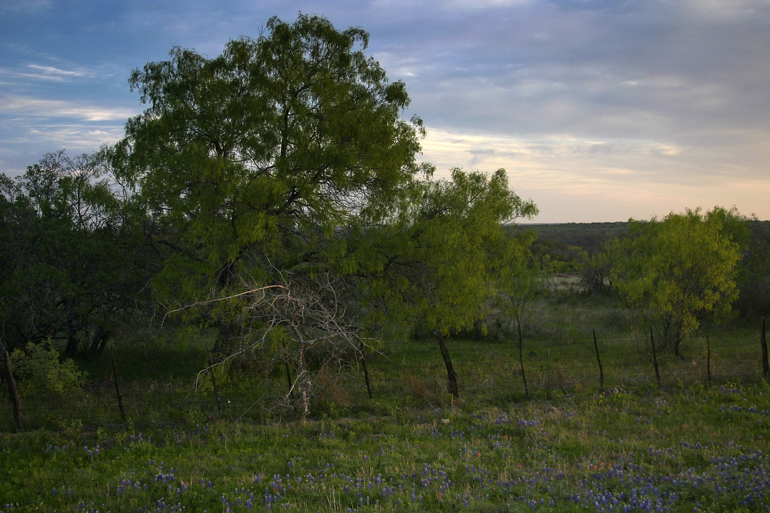
After two days of rain, I was really looking forward to my hill country reconnaissance as the cloud cover started to break up. Now, don't get me wrong. I'm not complaining about the rain. We got about 5 inches during the two days, and I'm grateful for that. I saw plenty of bluebonnets yesterday along the roadside as I made my way past Inks Lake, Kingsland, Llano, Enchanted Rock, Fredericksburg, and Marble Falls. My problem was that the two days' rain led me to anticipate large blooms and extravagant color. Instead, the flowers were smaller than I expected and the color uninspiring. I might have turned back or changed plans on the fly to take advantage of the fact that I was cruising the hill country with my camera on a beautiful day, but I persevered with my scout. I didn't worry about the flowers, just kept my eyes open and made notes of where I should return next week when the colors peak.

I was sure that I wandered off on my major bluebonnet tour last year during the second week of April; the drive yesterday was just in case the wildflowers reached their peak a little earlier this year. Well, as it turned out, I enjoyed the drive, took but a few pictures, and looked forward to next week. But, alas, when I checked the blog for last year's posts I discovered yesterday's trip was only two days ahead of last year's peak color. It seems I screwed around and missed the boat for 2013. Be that as it may, I did get some pictures yesterday and, though they weren't what I had gone out for, they're not terrible and provide fodder for my continuing PS education.

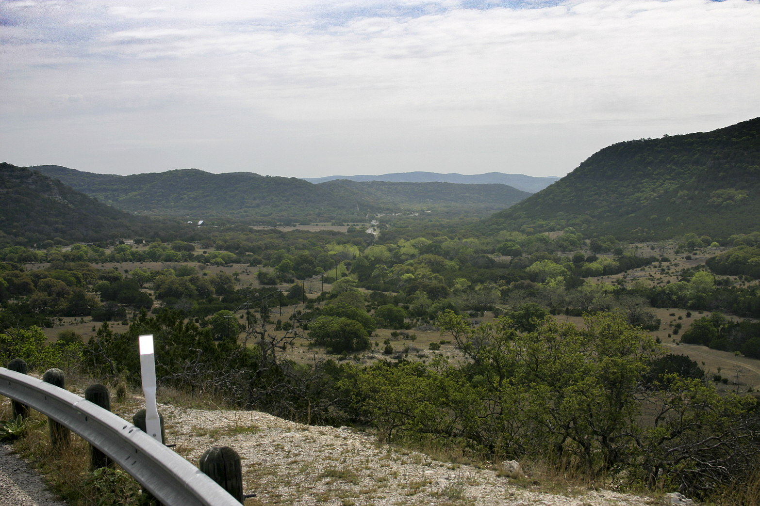
This was as much an exercise in PS techniques as anything else. I like the composition, the color and, after adding a tone gradient in the bottom left corner, I'm pleased with the lighting too. Not much here in the way of the flowers I'd come looking for, but I like the vantage point, looking down from an overlook on Park Road 4 approaching Inks Lake from Texas 29.

This is the overlook, which I shared with a couple of elderly ladies - also taking pictures. Between shots, I looked at both of them - at opposite ends of the overlook - and was completely surprised at the realization that they were probably my own age. You're not really as old as you feel. Usually, you're older.


These two shots (above & below) constitute a paean to the zoom lens. I took them from vantage points several feet and a few minutes apart, but point of interest - the rocky bed of Spring Creek - is obviously the same in both shots. Zoom lenses make life so easy for today's photographers. This creek bed is more or less typical of Hill Country creeks.


Spring Creek feeds into Inks Lake at the Devils Watering Hole, shown in these shots (above & below) just beneath the overlook.


Half a mile up the road, towards the park entrance, a bridge crosses Spring Creek. As long as I've been coming here, I must have crossed the bridge 50 times or more. Yesterday was the first time I gave it more than a glance. Of course, I was probably driving every time I crossed it and I do try to pay attention to the road. But this is a nice view, and one would think I'd have stopped at least once before. . .

No, I didn't paint this. While I was working with the image it occurred to me how much the composition looked like a painting and wondered what it would look like on canvas. My first thought on looking at it was that I wish I could have painted it. Then I thought, "Stephen ought to come out here and paint it." Then I thought how uncomfortable he would be standing at his easel, his back to traffic, as cars, trucks and motorcycles zoom past. Then I thought, "Ain't digital photography grand!"

There followed a lot of driving, some slowing down to take a look at a view or two faster drivers would probably miss, but not much stopping to take pictures. After all, I was still under the impression that I was ahead of the curve in regards to the wildflowers' peak. If I found a great view, I could swing by and catch it next week.

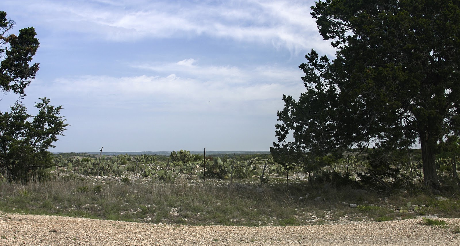
I was enjoying the drive and the exceptionally pleasant weather, however, and the two day's of rain had cleared the haze so prevalent during our continuing drought. I took a couple shots as I approached Enchanted Rock from the northeast, but they were into the sun and I didn't expect much. Having passed the Rock and being familiar with the view from the direction of Fredericksburg, I expected better lighting at this time of day, but also that the view would be partially hidden around the curve. I had not taken into account the difference 20 or 30 feet would make from the eastern verge of the road to the stand of agave and cactus on the western side. I'd caught a glimpse in the mirror as I came around the corner and veered to a screeching halt amid reflector posts with nary a scratch. The clear air, the time of day, and the extra 20 or 30 feet made all the difference.

If you're unfamiliar with Enchanted Rock, it's a granite batholith (underground rock formation uncovered by erosion), second in size only to Georgia's Stone Mountain in the United States. It was acquired in 1978 by the Nature Conservancy of Texas from the Moss family of ranchers, then deeded to Texas Parks and Wildlife in 1984. There's a Parks and Wildlife video on YouTube, here.